 Vietnam's cruise ports, measured from the gangway

Ports · An Giang
Phu Quoc: an island call, measured from An Thoi
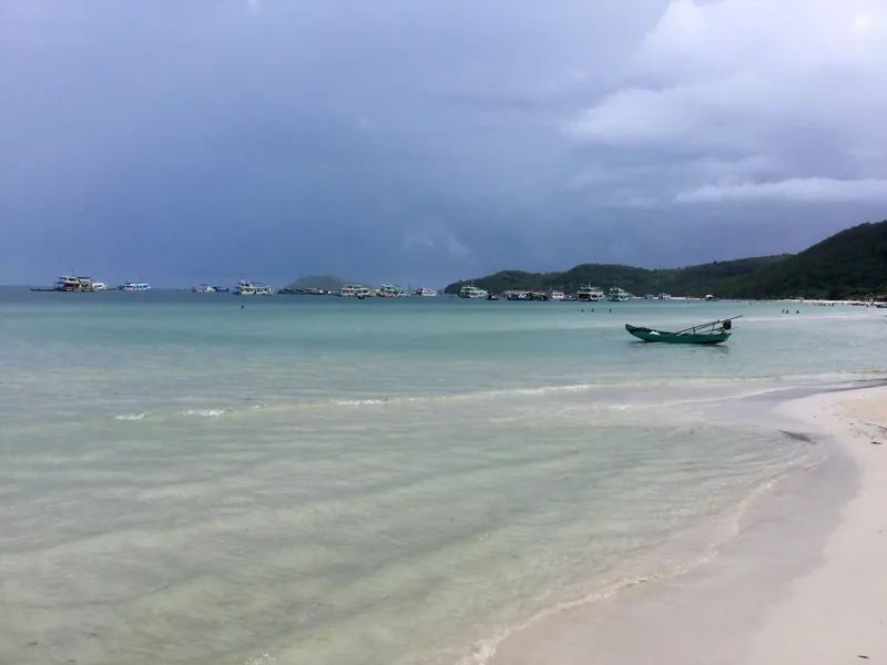
Phu Quoc is an island in the Gulf of Thailand, now a special zone of An Giang province. Cruise calls here are about beaches and the southern tip, with the main town half an hour up the coast, and they depend more on the sea than any other Vietnamese port.
At a glance
- Port names
- An Thoi; Duong Dong
- Sao Beach from An Thoi
- 8 km
- Duong Dong from An Thoi
- 30 km
- Stormy months
- July to September
- Typical call
- 7 to 10 hours
- Status
- Special zone of An Giang
Sources: OpenStreetMap road data routed with the OSRM engine (our calculation, free-flow times); Vietnam National Authority of Tourism — weather and climate; Dien Dan Doanh Nghiep — Phu Quoc becomes a special zone of An Giang · last checked .
What the island call actually is
Phu Quoc became a special zone on 1 July 2025, when Kien Giang merged into An Giang. The zone covers more than 589 square kilometres and includes the two former wards of Duong Dong, the main town on the west coast, and An Thoi, the port town at the southern tip. Both appear on Vietnam's list of e-visa seaports: Duong Dong was already listed, and An Thoi was added by Resolution 389 in December 2025.
We could not confirm from an official source whether ocean ships currently berth at An Thoi or anchor offshore and tender, and the itineraries we read do not say. Plan for a tender unless your line states otherwise; that means a queue to leave the ship, a boat ride to the landing, and the same in reverse, with the last tender leaving well before the ship sails.
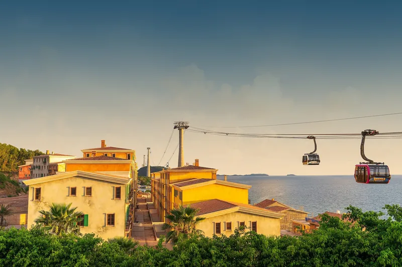
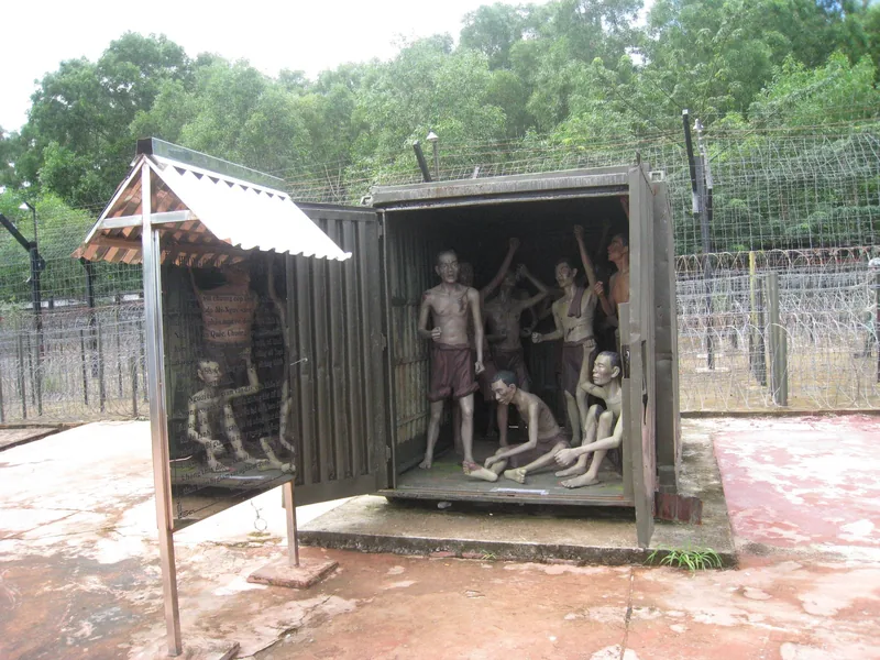
The island is large. An Thoi, at the south, is close to the beaches of the south-east coast, the former prison site and the cable car to Hon Thom island. Duong Dong, with its night market and the Dinh Cau shrine on the rocks, is about 30 km north. The Grand World entertainment district in the north-west is close to 50 km away.
Sources: Dien Dan Doanh Nghiep — Phu Quoc becomes a special zone of An Giang; Government of Vietnam news portal — Resolution 389/NQ-CP adds e-visa ports; OpenStreetMap Nominatim — coordinates and current ward and province names; OpenStreetMap road data routed with the OSRM engine (our calculation, free-flow times) · last checked .
Distances from An Thoi
| From An Thoi port to | Road distance | Free-flow drive | Planning time each way |
|---|---|---|---|
| Cable car station to Hon Thom, An Thoi town | Within An Thoi | — | 5 to 15 min |
| Phu Quoc prison historic site | 4 km | 4 min | 10 to 15 min |
| Sao Beach | 8 km | 12 min | 15 to 25 min |
| Phu Quoc airport | 21 km | 24 min | 30 to 40 min |
| Duong Dong, Dinh Cau shrine | 30 km | 28 min | 35 to 50 min |
| Grand World, north-west | 48 km | 51 min | 1 h to 1 h 15 |
Distances are measured from An Thoi port. If your ship tenders to a landing off Duong Dong instead, swap the picture: the town is at hand and the southern beaches are 30 km away.
Sources: OpenStreetMap road data routed with the OSRM engine (our calculation, free-flow times); OpenStreetMap Nominatim — coordinates and current ward and province names · last checked .
What fits in a typical call
Assume nine hours at anchor, about an hour in total for tenders, 45 minutes for the first queue and the landing, and a return to the tender pier an hour before the last boat. That leaves about six hours ashore.
- The south: Sao Beach, the prison site, An Thoi. Short drives, so most of the six hours is yours.
- The Hon Thom cable car. The station is in An Thoi town. It fits with time to spare, but queues and wind decide the day, so keep a margin.
- Duong Dong. About forty minutes each way. The town, Dinh Cau and the market area fit, but the night market is after many ships have sailed.
- South and north together. An Thoi beaches in the morning and Grand World in the afternoon means more than two hours of road. Tight on an ordinary call.
When to go
Vietnam's tourism authority describes Phu Quoc's stormy, humid season as July to September, when bad weather can disrupt ferries, and October to June as hot and dry. A 2022 VnExpress guide puts the settled period at November to April, with a calm sea and clear water, and notes that summer weather sometimes stops sea transport. For a cruise call, the sea matters more than the rain: tenders stop in a swell long before roads close.
3 = calm and dry more often; 2 = hotter, showers possible; 1 = stormy months when tenders and boats are most likely to be stopped. From the tourism authority and VnExpress descriptions.
Sources: Vietnam National Authority of Tourism — weather and climate; VnExpress — when to visit Phu Quoc (11 November 2022) · last checked .
Getting around and rough costs
Taxis and app cars operate on the island. The UK Foreign Office advice for Vietnam applies here too: metered taxis from larger firms or the Grab and XanhSM apps, the full journey booked in the app, and the car checked against the app before you get in. If you go north to Duong Dong or Grand World, fix the return time with the driver before you leave An Thoi.
| Item | Rough range | Note |
|---|---|---|
| Taxi from An Thoi to Sao Beach | A short local fare | About 8 km |
| Car from An Thoi to Duong Dong and back | A half-day hire | About 60 km round trip |
| Hon Thom cable car | One of the larger costs of the day | Check the current price on the day |
| Beach loungers and drinks | Small charges | Often paid in cash |
We found no dated official prices for these items on the day we checked, so we give ranges only. Check before you go.
Sources: UK Foreign Office — Vietnam safety and security; OpenStreetMap road data routed with the OSRM engine (our calculation, free-flow times) · last checked .
Pictures


Who should skip going far, and when not to go ashore
- Passengers with mobility problems on a tender call in a swell. Stepping between a ship and a moving tender is the hardest moment of the day; the crew can refuse boarding if it is unsafe.
- Calls between July and September with strong wind forecast. Tenders may be suspended and the call cancelled.
- Anyone planning the Duong Dong night market. It is an evening activity, and many ships sail before dark.
- Passengers who want north and south of the island in one day. The road is longer than it looks on the map.
Common questions
Questions readers ask
Do cruise ships tender at Phu Quoc?
We could not confirm the current arrangement from an official source. Plan for a tender unless your cruise line says you will berth, and leave extra time for the queues.
How far is Sao Beach from An Thoi?
About 8 km by road, fifteen to twenty-five minutes by taxi.
Is Phu Quoc still part of Kien Giang?
No. Since 1 July 2025 it is a special zone of An Giang province, after Kien Giang merged into An Giang.
Does Phu Quoc have its own visa exemption?
Phu Quoc has had a special visa-exemption rule for foreigners staying only on the island, but we could not confirm its current wording against an official source on the day we checked. For a cruise call, follow the visa process your ship sets out.
Related
Read next

Ports
Ports
All six Vietnamese cruise ports in one table: road distances, planning times and what fits in a call.
Ports · Ho Chi Minh City
Phu My
Phu My port: no facilities at the berth, the road to Ho Chi Minh City, Vung Tau and Cu Chi, and what fits.
Understand the cruise
Missed ports
Why cruise calls in Vietnam are cancelled or shortened, how tendering works, and what your contract says.

Understand the shore day
Shore time
How to turn hours in port into real time at a sight, with worked examples for every Vietnamese port.
Understand the shore day
Visa and entry
Visa-free entry, the e-visa and the ship-arranged visa for cruise passengers, with the 2026 decree explained.
Understand the cruise
Cruise season
When ocean cruise ships call in Vietnam, the itinerary patterns, and the storm months that change calls.
Start planning
Send a correction or a question
Tell us which page you mean, what you found instead and when. A link to the source, or the details of your own call, helps us check it.