 Vietnam's cruise ports, measured from the gangway
Ports · Da Nang
Tien Sa: close to Da Nang, an easy road to Hoi An
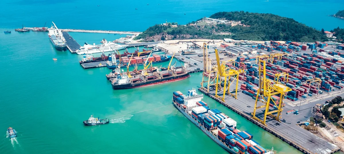
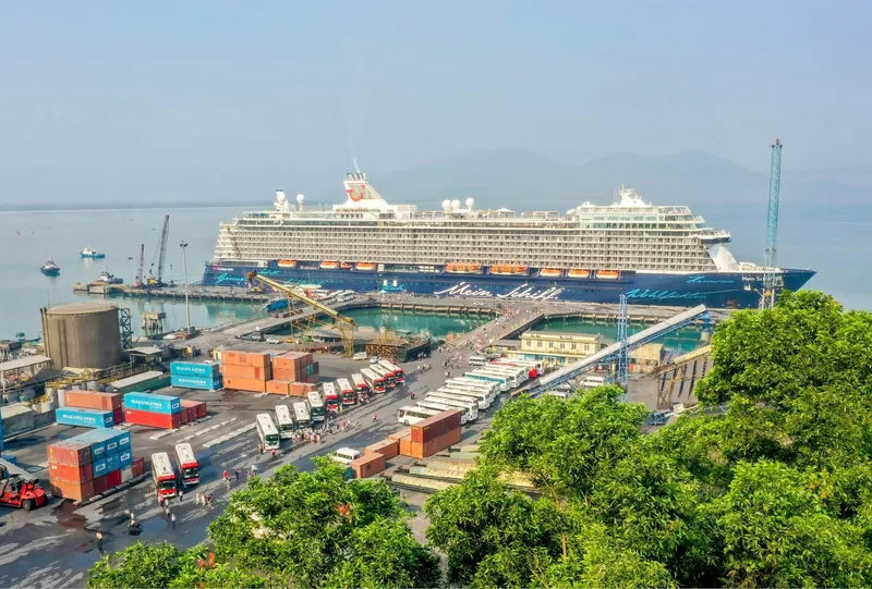
Tien Sa is Da Nang's main seaport, tucked under the Son Tra peninsula about twelve kilometres from the city's riverfront. It is the port in Vietnam that leaves cruise passengers the most choice in a single day.
At a glance
- Berth
- Tien Sa seaport, Son Tra ward
- City centre
- 12 km by road
- Hoi An
- 41 km by road
- Hue
- 108 km by road
- Typical call
- 8 to 10 hours
- City
- Da Nang
Sources: OpenStreetMap road data routed with the OSRM engine (our calculation, free-flow times); OpenStreetMap Nominatim — coordinates and current ward and province names · last checked .
What the port actually is
Tien Sa is a general seaport at the northern tip of Da Nang, on the sheltered side of the Son Tra peninsula. It is a quay port, and whether a given ship ties up alongside or anchors off is set for each call; the line's port notes say which applies to yours. The Da Nang port border gate has been on Vietnam's list of e-visa entry points since before the December 2025 expansion.
Since the 2025 provincial merger, Da Nang includes the former province of Quang Nam. That means Hoi An and the My Son sanctuary, long described as "near Da Nang", are now inside the same city. It changes the names on road signs and maps, not the distances.
Tien Sa and Chan May serve the same stretch of coast from either side of the Hai Van Pass. Whether your ship goes to one or the other depends on its size and the berth available. From Tien Sa, Hoi An is easy and Hue is the long day; from Chan May it is the other way round.
Sources: Government of Vietnam news portal — Resolution 389/NQ-CP adds e-visa ports; Bao Lao Cai — National Assembly Resolution 202/2025/QH15 on merging provinces; OpenStreetMap Nominatim — coordinates and current ward and province names · last checked .
Distances from the berth
| From Tien Sa to | Road distance | Free-flow drive | Planning time each way |
|---|---|---|---|
| Linh Ung pagoda, Son Tra | 10 km | 13 min | 20 to 30 min |
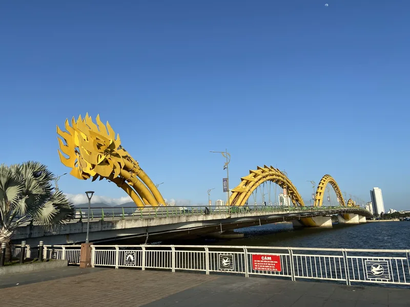
| Dragon Bridge and the riverfront | 12 km | 13 min | 20 to 35 min |
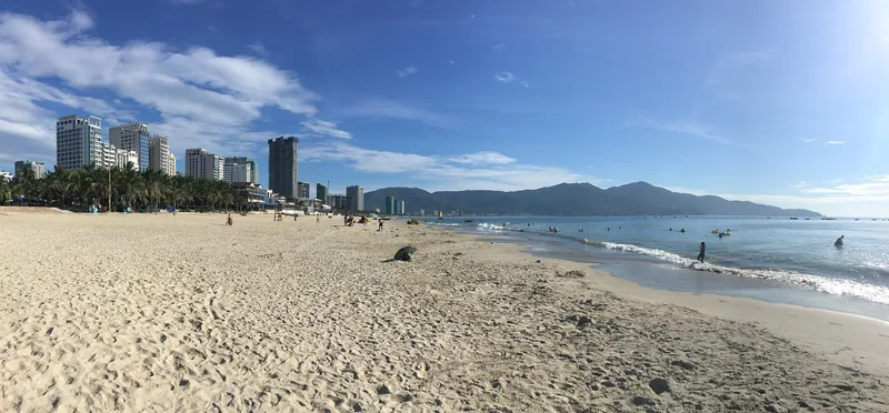
| My Khe beach | 13 km | 14 min | 20 to 35 min |
| Marble Mountains | 18 km | 22 min | 30 to 45 min |
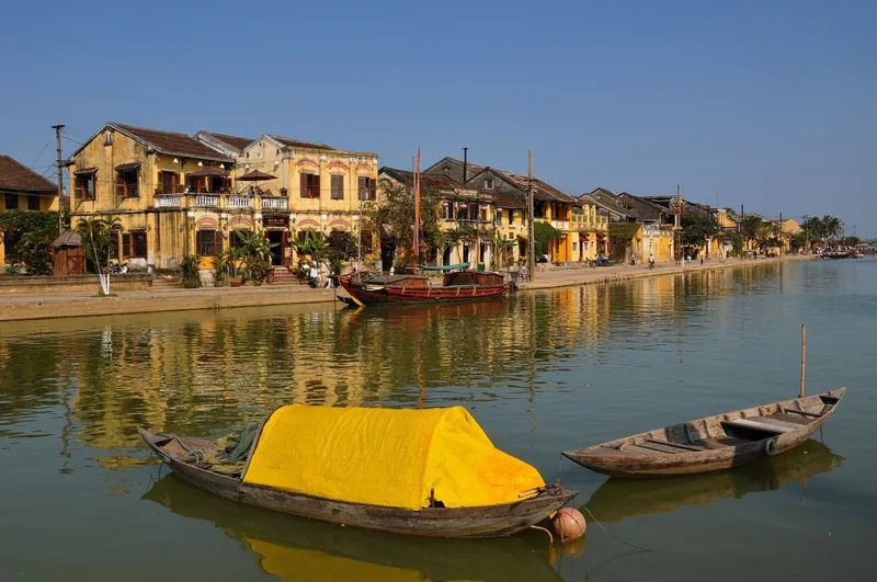
| Hoi An old town | 41 km | 39 min | 45 min to 1 h |
| Ba Na Hills cable car area | 42 km | 40 min | 50 min to 1 h 10 |
| My Son sanctuary | 54 km | 55 min | 1 h to 1 h 20 |
| Hue Imperial City | 108 km | 1 h 38 min | 2 h to 2 h 30 |
Distances are by road from the port, calculated from OpenStreetMap data. The planning times allow for the port gate, city traffic and the bridges over the Han River, which are slower at the start and end of the working day.
Sources: OpenStreetMap road data routed with the OSRM engine (our calculation, free-flow times) · last checked .
What fits in a typical call
With nine hours in port, 45 minutes to get off and out, and a return one hour before departure, you have about seven and a quarter hours.
- Hoi An. One and a half to two hours of road in total leaves five hours or more: the old town, a meal and time by the river. This is the plan the port makes easy.
- Da Nang itself. Son Tra, the riverfront and Marble Mountains fit together in a half or full day with short drives between them.
- Ba Na Hills. Under an hour each way, plus the cable car queue. Fits, but the queue on busy days is the unknown, so keep a two-hour margin.
- My Son. About an hour each way. My Son and Hoi An together is tight but possible on a ten-hour call.
- Hue. Four to five hours of road leaves two and a quarter to three and a quarter hours in Hue. Tight; consider it only on a long call.
When to go
Vietnam's tourism authority gives no separate climate description for Da Nang, but places Hoi An, 41 km away, in a rainy, cool season from September to January with floods possible from September to November, and a warm to hot, sunny season from February to August. The UK Foreign Office describes central Vietnam's rains as October to December, with seasonal flooding in October and November.
3 = dry and settled; 2 = mixed; 1 = rainy, autumn floods possible. From the tourism authority's Hoi An description, the closest it publishes to Tien Sa.
Sources: Vietnam National Authority of Tourism — weather and climate; UK Foreign Office — Vietnam safety and security · last checked .
Getting around and rough costs
Taxis and ride-hailing cars reach the port area. The UK Foreign Office recommends metered taxis from larger firms or the Grab and XanhSM apps, and warns about drivers posing as app cars. For Hoi An, a car with a driver for the day is the usual way for a small group to keep control of the return time.
| Item | Rough range | Note |
|---|---|---|
| Taxi or app car to the city centre | A short city fare | About 12 km; use the meter or the app |
| Car with driver to Hoi An and back | A half-day to full-day hire | Agree the return time in writing |
| Hoi An old town ticket | Charged to visitors | Confirm the current price at the ticket booth |
| Ba Na Hills cable car | A combined admission ticket | One of the larger costs of the day; check online |
We do not give exact prices here because we did not find a dated official source for them on the day we checked. Check before you go.
Sources: UK Foreign Office — Vietnam safety and security · last checked .
Pictures



Who should skip the long trips, and when not to go far
- Passengers on a short call, under eight hours. Keep to Da Nang or Hoi An; drop Hue.
- Anyone planning Ba Na Hills on a weekend or public holiday with a tight all-aboard. Queues for the cable car are the part you cannot predict.
- Calls in October and November with heavy rain forecast. Roads to My Son and the hills can be affected first.
- Passengers who want a quiet beach day in the old town. Hoi An is busiest in the late afternoon and evening, after many ship passengers have gone, but the middle of the day is still crowded on cruise days.
Common questions
Questions readers ask
How far is Tien Sa from Hoi An?
About 41 km by road. Plan on 45 minutes to an hour each way.
Can I walk from Tien Sa into Da Nang?
Not practically. The city centre is about 12 km by road; take a taxi, an app car or the ship's shuttle if there is one.
Is Hoi An now part of Da Nang?
Yes. Under the 2025 provincial merger, the former Quang Nam province, including Hoi An, became part of Da Nang city. The distances have not changed.
Can I do Hue from Tien Sa?
Only on a long call. At about 108 km each way, the road takes four to five hours of the day.
Related
Read next

Ports
Ports
All six Vietnamese cruise ports in one table: road distances, planning times and what fits in a call.
Ports · Hue
Chan May
Chan May port: berth facts, distances to Hue, Da Nang and Hoi An, the Hai Van Pass and the one-direction rule.

Understand the shore day
Shore time
How to turn hours in port into real time at a sight, with worked examples for every Vietnamese port.
Understand the cruise
Cruise season
When ocean cruise ships call in Vietnam, the itinerary patterns, and the storm months that change calls.

Understand the shore day
Visa and entry
Visa-free entry, the e-visa and the ship-arranged visa for cruise passengers, with the 2026 decree explained.

Understand the cruise
Missed ports
Why cruise calls in Vietnam are cancelled or shortened, how tendering works, and what your contract says.
Start planning
Send a correction or a question
Tell us which page you mean, what you found instead and when. A link to the source, or the details of your own call, helps us check it.